


Boone Precinct, Boone County, Nebraska
About
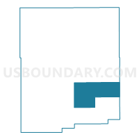
Outline

Summary
| Unique Area Identifier | 612442 |
| Name | Boone Precinct |
| County | Boone County |
| State | Nebraska |
| Area (square miles) | 50.77 |
| Land Area (square miles) | 50.77 |
| Water Area (square miles) | 0.00 |
| % of Land Area | 100.00 |
| % of Water Area | 0.00 |
| Latitude of the Internal Point | 41.61905070 |
| Longtitude of the Internal Point | -97.95072490 |
Maps


Graphs
Select a template below for downloading or customizing gragh for Boone Precinct, Boone County, Nebraska


Neighbors
Neighoring Voting District (by Name) Neighboring Voting District on the Map
- Beaver Precinct, Boone County, NE
- Cedar Precinct, Boone County, NE
- Southeast Manchester Precinct, Boone County, NE
- Southwest Manchester Precinct, Boone County, NE
- Walker/Woodville Precinct, Platte County, NE
Top 10 Neighboring County Subdivision (by Population) Neighboring County Subdivision on the Map
- Southeast Manchester precinct, Boone County, NE (943)
- Southwest Manchester precinct, Boone County, NE (927)
- Beaver precinct, Boone County, NE (866)
- Cedar precinct, Boone County, NE (609)
- Boone precinct, Boone County, NE (248)
- Walker township, Platte County, NE (247)
- Woodville township, Platte County, NE (155)
Top 10 Neighboring Unified School District (by Population) Neighboring Unified School District on the Map
- Boone Central Schools, NE (3,658)
- Newman Grove Public Schools, NE (1,406)
- St. Edward Public Schools, NE (1,061)
- Cedar Rapids Public Schools, NE (896)
Top 10 Neighboring State Legislative District Upper Chamber (by Population) Neighboring State Legislative District Upper Chamber on the Map
Top 10 Neighboring 111th Congressional District (by Population) Neighboring 111th Congressional District on the Map
Top 10 Neighboring Census Tract (by Population) Neighboring Census Tract on the Map
- Census Tract 9651, Platte County, NE (3,737)
- Census Tract 9601, Boone County, NE (3,626)
- Census Tract 9602, Boone County, NE (1,879)